We have updated our Privacy Policy Please take a moment to review it. By continuing to use this site, you agree to the terms of our updated Privacy Policy.
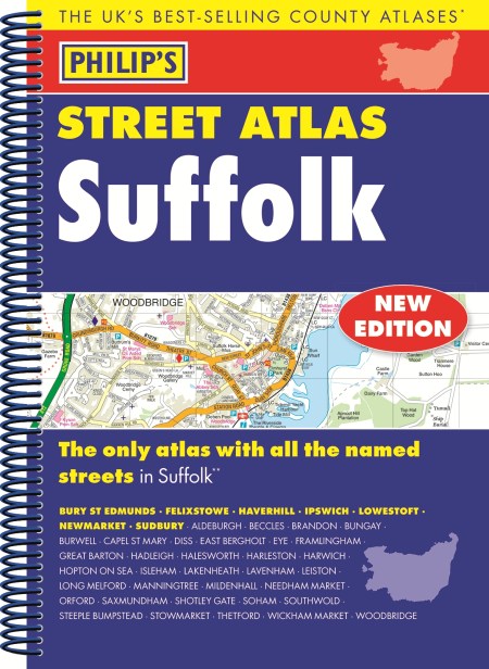
THE ONLY COUNTY STREET ATLAS WITH ALL THE NAMED STREETS OF SUFFOLK
The UK’s best-selling county street atlases
More than 24,000 named streets, roads, lanes and alleys
The essential map book for residents and visitors – and if you’re moving to Suffolk
Includes all the streets in BURY ST EDMUNDS, FELIXSTOWE, HAVERHILL, IPSWICH, LOWESTOFT, NEWMARKET, SUDBURY, Aldeburgh, Beccles, Brandon, Bungay, Burwell, Capel St Mary, Diss, East Bergholt, Eye, Framlingham, Great Barton, Hadleigh, Halesworth, Harleston, Harwich, Hopton on Sea, Isleham, Lakenheath, Lavenham, Leiston, Long Melford, Manningtree, Mildenhall, Needham Market, Orford, Saxmundham, Shotley Gate, Soham, Southwold, Steeple Bumpstead, Stowmarket, Thetford, Wickham Market, Woodbridge.
– New edition in practical spiral-bound format
– Street maps show car parks, schools, hospitals and many other places of interest, even ones off the beaten path
– 4-page practical route-planning section showing all A and B roads
– Super-clear mapping
– Easy-to-use index
– Scales: 1¾ inches to 1 mile (1:36,000) and 3½ inches to 1 mile (1:18,000). Major towns: 7 inches to 1 mile (1:9,000).
Other information on the maps includes postcode boundaries, car parks, railway and bus stations, post offices, schools, colleges, hospitals, police and fire stations, places of worship, leisure centres, footpaths and bridleways, camping and caravan sites, golf courses, and many other places of interest.
Newsletter Signup
By clicking ‘Sign Up,’ I acknowledge that I have read and agree to Hachette Book Group’s Privacy Policy and Terms of Use